首页 | 本学科首页   官方微博 | 高级检索  
     

地震面波与重力联合成像分析苏拉威西周缘壳幔热-流变学结构
引用本文:姜程浩, 张健, 李志伟, 郝天珧, 董淼, 方桂. 2023. 地震面波与重力联合成像分析苏拉威西周缘壳幔热-流变学结构. 地球物理学报, 66(7): 2961-2972, doi: 10.6038/cjg2022Q0364
作者姓名:姜程浩  张健  李志伟  郝天珧  董淼  方桂
作者单位:中国科学院大学,北京 100049;北京卫星环境工程研究所,北京 100094;中国科学院大学,北京 100049;中国科学院地质与地球物理研究所,北京 100029;中国科学院地球科学研究院,北京 100029;中国科学院地质与地球物理研究所,北京 100029
基金项目:国家自然科学基金(42176052,91858212,41906056);;国家重点研发计划重点专项(2021YFA0716002)联合资助;
摘    要:

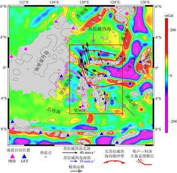
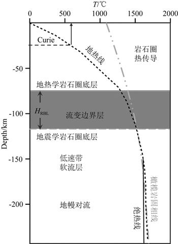
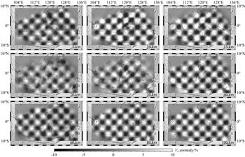
苏拉威西岛位于苏拉威西海、班达海之间, 是研究海陆耦合、俯冲后撤等地球动力学问题的重要地区.本文利用这一地区24台宽频带地震台站记录的地震面波和背景噪声数据中提取出的面波频散数据和来自卫星的重力异常数据, 开展了地震面波与重力联合层析成像反演, 获得了苏拉威西周缘地区深至240 km深度的三维VS速度模型.基于三维波速模型, 本文利用热-流变学方法, 计算了该区岩石圈底界的热流变学边界层厚度、黏性变化特征, 结果表明: (1) 苏拉威西岛岩石圈流变边界层东南厚、西北薄, 这可能导致新生代苏拉威西岛在陆壳碎块位移与重组过程中, 岛东支的东部北向速率最大, 岛北支西部北向速率次之; (2) 北苏拉威西海沟俯冲后撤板片上覆地壳对应S波波速低值异常区, 可能代表了富含流体的软弱板片, 推测苏拉威西俯冲带是一个慢速俯冲带, 且后撤过程不连续.


关 键 词:苏拉威西岛  面波与重力联合成像  热流变边界层  海陆耦合  俯冲后撤
收稿时间:2022-05-30
修稿时间:2023-05-28

Thermal rheological structure analysis of crustand upper mantle in Sulawesi based on joint tomography of surface wave and gravity data
JIANG ChengHao, ZHANG Jian, LI ZhiWei, HAO TianYao, DONG Miao, FANG Gui. 2023. Thermal rheological structure analysis of crustand upper mantle in Sulawesi based on joint tomography of surface wave and gravity data. Chinese Journal of Geophysics (in Chinese), 66(7): 2961-2972, doi: 10.6038/cjg2022Q0364
Authors:JIANG ChengHao  ZHANG Jian  LI ZhiWei  HAO TianYao  DONG Miao  FANG Gui
Affiliation:1. University of Chinese Academy of Sciences, Beijing 100049, China; 2. Institute of Geology and Geophysics, Chinese Academy of Sciences, Beijing 100029, China; 3. Beijing Institute of Spacecraft Environment Engineering, Beijing 100094, China; 4. Innovation Academy for Earth Science, Chinese Academy of Sciences, Beijing 100029, China
Abstract:Sulawesi is an important area to study geodynamic problems of ocean-continent coupling and subduction rollback. In this paper, according to the surface wave dispersion data extracted from seismic surface wave and ambient noise from 24 broadband seismic stations and the satellite gravity anomaly data, we used the joint tomographic inversion to obtain the three-dimensional VS velocity model up to 240 km around Sulawesi. Based on this velocity model, we calculated the thickness and viscosity variation characteristics of the thermal rheological boundary layer at the bottom of the lithosphere by the thermal rheological method. The results suggest that: (1) the rheological boundary layer of the lithosphere in Sulawesi island is thick in the southeast and thin in the northwest, resulting in the maximum northward velocity in the east of the East Branch of Sulawesi island and the second in the west of the North Branch of Sulawesi island during the continental crust fragment displacement and reorganization in the Cenozoic; (2) The low VS anomalous velocity zone corresponding to the overlying crust of the subduction retreating plate of the North Sulawesi trench may be a fluid-rich weak plate. And the Sulawesi subduction is thought to be a sluggish subduction with discontinuous retreating.
Keywords:Sulawesi  Joint tomography  Thermal rheological boundary layer  Ocean continent coupling  Rollback
本文献已被 万方数据 等数据库收录!
点击此处可从《地球物理学报》浏览原始摘要信息
点击此处可从《地球物理学报》下载全文
设为首页 | 免责声明 | 关于勤云 | 加入收藏

Copyright©北京勤云科技发展有限公司  京ICP备09084417号