Landsat 8 vs. Landsat 5: A comparison based on urban and peri-urban land cover mapping |
| |
| Affiliation: | 1. Foundation for Research and Technology - Hellas (FORTH), Institute of Applied and Computational Mathematics, N. Plastira 100, Vassilika Vouton, 70013 Heraklion, Greece;2. Earth Observation Lab, University of Tor Vergata, Rome, Italy;1. Graduate School of Life and Environmental Sciences, University of Tsukuba, Tennoudai 1-1-1, Tsukuba, Ibaraki 305-8572, Japan;2. Faculty of Life and Environmental Sciences, University of Tsukuba, Tennoudai 1-1-1, Tsukuba, Ibaraki 305-8572, Japan;3. Kasumigaura Environmental Science Center, Okijuku-machi 1853, Tsuchiura, Ibaraki 300-0023, Japan;1. Institute of Agriculture and Environment, Massey University, Palmerston North 4474, New Zealand;2. Faculty of Natural Resource Management, Thai Nguyen University of Agriculture and Forestry, Thai Nguyen City 25000, Viet Nam |
| |
| Abstract: | 
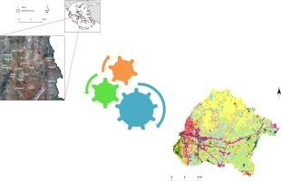
An image dataset from the Landsat OLI spaceborne sensor is compared with the Landsat TM in order to evaluate the excellence of the new imagery in urban landcover classification. Widely known pixel-based and object-based image analysis methods have been implemented in this work like Maximum Likelihood, Support Vector Machine, k-Nearest Neighbor, Feature Analyst and Sub-pixel. Classification results from Landsat OLI provide more accurate results comparing to the Landsat TM. Object-based classifications produced a more uniform result, but suffer from the absorption of small rare classes into large homogenous areas, as a consequence of the segmentation, merging and the spatial parameters in the spatial resolution (30 m) of Landsat images. Based exclusively on the overall accuracy reports, the SVM pixel-based classification from Landsat 8 proved to be the most accurate for the purpose of mapping urban land cover, using medium spatial resolution imagery. |
| |
| Keywords: | Landsat 8 SVM GEOBIA Peri-urban Classification |
| 本文献已被 ScienceDirect 等数据库收录! |
|

